In September 2017, Ashley Schmeltzer, a GIS Officer with American Red Cross, led a community mapping training with Belize Red Cross. She was invited back, and was accompanied this time by her colleague Dan Joseph, to conduct a more advanced mapping training that included sessions on the use of drones for mapping.

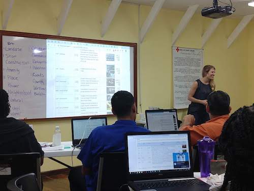
Ashley leading a discussion on OSM map features attribute tagging. CC-BY American Red Cross
The two of them led training and hands-on experience for the participants in:
All of the above tools can augment and improve the collection of geospatial data. The objective of the workshop was to improve OpenStreetMap for Disaster Risk Reduction (DRR) activities and preparedness. For example, for improved community mapping when Belize Red Cross conducts IFRC Vulnerability and Capacity Assessment (VCA) in communities around the country.
Belize Red Cross invited participants from the Belizean government. There was representation from the National Emergency Management Organization (NEMO), the Ministry of Natural Resources, and the Ministry of Education.
There was some great cross-learning. The Ministry of Natural Resources has been using drones for various monitoring and assessment activities but had not yet processed image sets into products such as georectified orthomosaics. We learned about their workflows and they were excited to learn about the geographic data products that could be produced with OpenDroneMap.
Disaster preparedness and response is more effective when organizations can effectively coordinate, so it was great to see such a diverse group of participants. Additionally, Belize Red Cross provided NEMO with the same set of equipment that they procured for themselves. Future coordination of mapping and assessment activities will maximize the use of available time and resources.
We look forward to hearing about how the participants are able to incorporate the various technological tools and mapping methodologies into their future work. And hopefully we can visit Belize again to continue the teaching and learning that happens for everyone involved in activities like this.

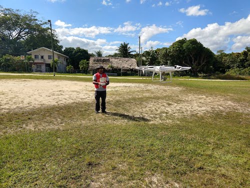
Launching and practicing manual control of the Belize Red Cross drone. CC-BY American Red Cross

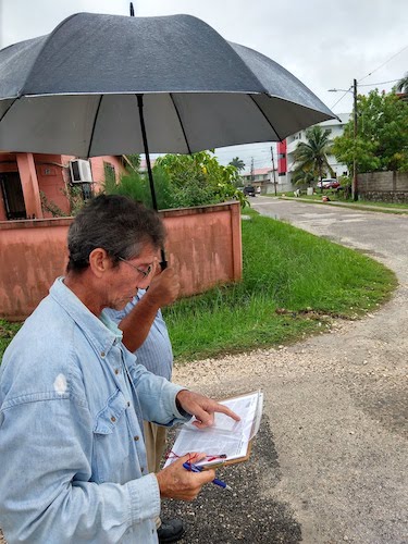
A little rain didn’t stop us! Participants were well prepared with plastic sheet protectors and umbrellas. CC-BY American Red Cross
Some additional coverage:
The @OpenStreetMap made the local news last night, w/ a story featuring a collaboration between the Belize Red Cross and the [American] @RedCross. The feature was by reporter @HipolitoNovelo of @Channel5Belize.https://t.co/sKVruA5kQe pic.twitter.com/YXjOEBKo9B
— 🇧🇿 Belize GEO 🛰️ (@BZgeo) January 17, 2019