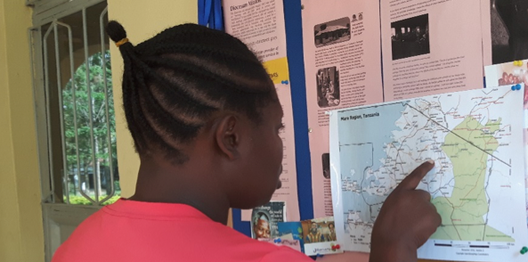
Fighting FGM in Tanzania
I first met Rhobi in a building site in Mugumu, Serengeti, Tanzania, in September 2014 where she was desperately trying to get a Safe House for girls refusing Female Genital Mutilation finished before the “cutting season” started in December. In the week we spent together I accompanied her and her team as they visited the surrounding villages, telling the villagers the dangers of FGM through debates, drama and dance. Rhobi almost bled to death from FGM in one of these villages as a 13 year old and has been a passionate advocate for womens’ rights ever since.
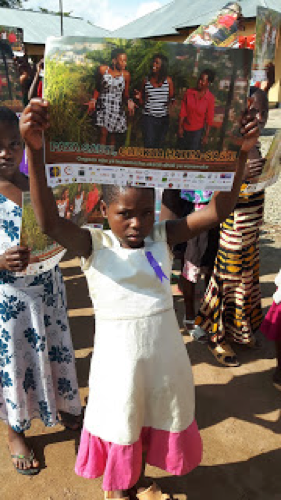
CC BY-SA Janet Chapman
As we bounced along the dusty tracks in a rusty over crowded car, frequently getting lost and stopping to ask for directions, I was frustrated by everyone’s complete lack of maps. I had been inspired to learn about Openstreetmap at Wikimania London the previous month, and had even printed out basic maps to ask Rhobi to mark villages on before I visited. That was a failure, as was my mapping attempts that time. No one I met had a good understanding of where the villages were on paper and I was thwarted by poor connectivity and inadequate tools or understanding. Later on my trip I was amazed to find my GPS at Zeze, and village of 9000 people showed a completely blank map. I was 2 hours late visiting Ikondo School after driving round in circles through muddy rivers in torrential rain trying to find it.
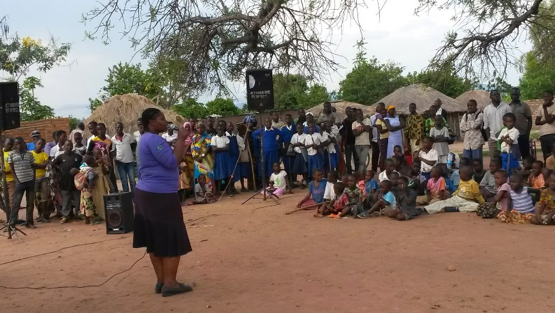
CC BY-SA Janet Chapman
At Mozfest in October 2015 I met Egle, a citizen science expert talking about mapping the locations of water points and other objects using EpiCollect. I told her of our need to map village locations. She was shocked to learn that the online maps were still so poor in places like rural Tanzania, and together we started Crowd2Map, a crowdsourced mapping project, using remote and local mappers.
When Maps.Me produced their version that allowed edits into Openstreetmap we started using it instead, including developing a Swahili version. We held a mapping party in Dar es Salaam, with Ramani Huria, London, Vilnius and the Safe House in May 2016.
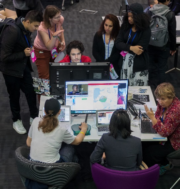
CC BY-SA Janet Chapman
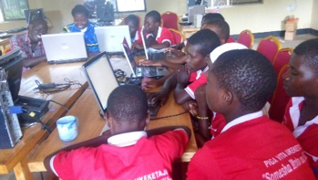
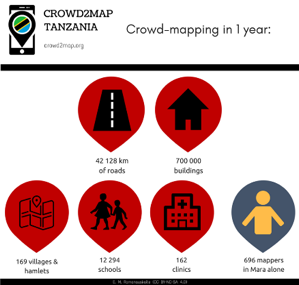
We’ve now recruited over 900 online volunteers and 199 local mappers. In our 2 HOT tasks in Mara region 696 mappers have mapped an area of 14,248 square kilometres and added 5 towns and 169 villages and hamlets. We’ve also added 42,128 km of roads and tracks and 700,000 buildings.. Countrywide we have added 12,294 schools and 162 clinics to Openstreetmap from government open data.
CC BY-SA Janet Chapman
When I visited the Safe House for the 5th time in December 2016 I took out a printed map. This, together with Maps.Me on Rhobi’s phone meant that when a phone call came in saying “there is a girl in Sogoti village who needs rescuing from cutting tonight” she knew where to go.
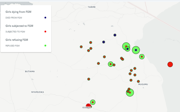
Having better maps helped prevent 2257 girls from being cut this year. However change is a slow process. 1076 girls were cut, down from 3700 the previous year, and 4 girls died, down from 12 last year. There is an interactive map showing the location of FGM incidents here.
Girls like Bhoke* forcibly cut at 13, her body thrown into the bush. But the tide is turning. This year saw the first prosecutions against parents and cutters for FGM.
CC BY-SA Janet Chapman
The Safe House sheltered over 200 girls this year. Girls like Jackline were saved from being cut and married off against their will. Now she can pursue her dream to become a teacher.
There is more information about this project in this 2 minute video on Al Jazeera, and this article in The Guardian.
Local mappers are continuing to improve the map by adding the names of missing villages across Tanzania, but we are a volunteer run project with no budget and access to smartphones is a limiting factor. If anyone has any unwanted phones we can make very good use of them! Please contact us here.
CC BY-SA Janet Chapman, web map

